


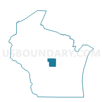
ALMOND - T 1 Voting District, Portage County, Wisconsin
About
Outline

Summary
| Unique Area Identifier | 696270 |
| Name | ALMOND - T 1 Voting District |
| County | Portage County |
| State | Wisconsin |
| Area (square miles) | 43.22 |
| Land Area (square miles) | 43.01 |
| Water Area (square miles) | 0.21 |
| % of Land Area | 99.51 |
| % of Water Area | 0.49 |
| Latitude of the Internal Point | 44.29470220 |
| Longtitude of the Internal Point | -89.42440640 |
Maps


Graphs
Select a template below for downloading or customizing gragh for ALMOND - T 1 Voting District, Portage County, Wisconsin


Neighbors
Neighoring Voting District (by Name) Neighboring Voting District on the Map
- Almond - V 1 Voting District, Portage County, WI
- BELMONT - T 1 Voting District, Portage County, WI
- BUENA VISTA - T 2 Voting District, Portage County, WI
- LANARK - T 2 Voting District, Portage County, WI
- OASIS - T 1 Voting District, Waushara County, WI
- PINE GROVE - T 1 Voting District, Portage County, WI
- PINE GROVE - T 2 Voting District, Portage County, WI
- PLAINFIELD - T 1 Voting District, Waushara County, WI
- ROSE - T 1 Voting District, Waushara County, WI
Top 10 Neighboring County Subdivision (by Population) Neighboring County Subdivision on the Map
- Lanark town, Portage County, WI (1,527)
- Buena Vista town, Portage County, WI (1,198)
- Pine Grove town, Portage County, WI (937)
- Almond town, Portage County, WI (680)
- Rose town, Waushara County, WI (640)
- Belmont town, Portage County, WI (616)
- Plainfield town, Waushara County, WI (550)
- Almond village, Portage County, WI (448)
- Oasis town, Waushara County, WI (389)